IS THAT YOUR FINAL WORD ? FISHBOWL EARTH

FISHBOWL EARTH

WE LIVE IN A FISHBOWL

Evidence suggests that we live in an enclosed Plan-Et surrounded by a huge ice wall. There is a huge World beyond that wall but we are forbidden to go beyond the 60th Parallel to see it. No plane can fly over it.

WE LIVE IN A FISHBOWL EARTH

We live in a Fishbowl with a powerful dome separating us from an ocean of water above. As above, So below.  But this is only one part of the immense realm.  In the 1900s we began to wake up to it and started to explore.  Admiral Byrd came back with news of the advance civilization beyond the Antarctic Ice Wall. The U.S. Navy tried to conquer this Race but was overwhelmed.  Then they tried to blast open the dome but could not. Now they have created a series of psyops to keep us distracted and disoriented while other beings rule our world and keep us as prisoner pets.
We are told that Antarctica is a continent at the bottom of the World but we aren’t allowed to look at it.

I call it Fishbowl |Earth; not Flat Earth because it is not an Isolated disk in Space.  The World is a place that is a mystery in the South and the North.  Google Earth does not show us anything at the two poles.  Planes are not allowed to fly over Antarctica. No one is allowed to travel beyond the 6oth parrallel or you will be arrested.  The united Nations uses the same Fishbowl Map as their logo.  The only Treaty in the World that has remained unnbroken is the Treaty of Antarctica.  The highly decorated Military explorer; Rear Admiral Richard Byrd says there is a vast world beyond the Ice Wall and has seen it.  But we are not allowed to.  I don’t know what is beyond our known World.  I just think there is something more that we are not allowed to see.

WORLD BEYOND THE ICEWALL

The Gleason’s Map is only a small part of Fishbowl Earth.  Rear Admiral Bird traveled beyond the Ice Wall in 1957 and saw a glimpse of these other lands.

SEE THIS MAP IN FULL SCALE

The World Beyond the Ice Wall is a collaborative worldbuilding venture that combines interests ranging from worldbuilding, alternate history, speculative evolution, conspiracy theories, cryptozoology, conlanging, ufology, mythology, occultism, geopolitics, and all sorts of paranormal and esoteric topics in an attempt to flesh out a world where not only are there continents beyond the ice wall, but one where every conspiracy theory is true. Every cryptid, every secret society, every occult concept, all the schizo paranormal stuff your crazy uncle posts about on facebook, all tied together in a single grand narrative that unifies the lore of Ufology, Lost civilizations, modern myths, urban legends and esoteric writings across the past few centuries. Basically, if you’re familiar with the conspiracy iceberg, what we want to is take everything from that and put it all together in one cohesive setting.
And what better world to cram all of that into than one proposed by a number of flat-earthers, where the disc-shaped map doesn’t end at the frozen wastelands of Antarctica, but extends beyond, to larger disc containing many more unknown continents capable of supporting life, with yet another barrier at its end, concealing an even larger realm an order of magnitude more expansive, and rich with worldbuilding opportunities. 

ADMIRAL BYRD SAYS ITS A HUGE WORLD

Rear Admiral Byrd made a huge voyage to Antarctica in 1947 and reported there is a huge World left to explore.  By the way did you notice that the backdrop of this studio is the same as the World Map above?  Fishbowl Earth.
Evidence suggests that we live in an enclosed Plan-Et surrounded by a huge ice wall. There is a huge World beyond that wall but we are forbidden to go beyond the 60th Parallel to see it. No plane can fly over it.

MOON PLASMA X-RAY OF FISHBOWL EARTH

The Moon reflects our known planet as well as the greater World beyond the poles.

OUR KNOWN EARTH IS PART OF THIS IMAGE

T”he area to the right in this Inverted image is the Earth as we know it from the Gleasons Map.

FISHBOWL  EARTH  IS  PART  OF  A  GREATER REALM

We live in Middle  Earth, surrounded by many other rings of worlds. Our world is reflected in a plasmic exray that we call the moon. Thisi is a colorized version of the Moon image above showing our known World in the colored area with the ring (ICE Wall) around it.  This World is slightly different from our modern map becasuse this X-ray is from a time when the Continents were slightly different.

MOON PLASMA X-RAY OF FISHBOWL EARTH

Here is another version of the pictures above; higlighting our known Earth World.

NOT A FLAT EARTH;  A GREATER REALM

One theory that I think makes sense is that we might live on a Planet after all but in a series of fishbowls with clear domes over them making up countless civilizations enclosed in their own atmospheres. As the diagram shows, Fishbowl earth could be just one of these World amongst Worlds.

FISHBOWL  EARTH  IS  PART  OF  A  GREATER REALM


http://www.librarising.com/flat/worldsbeyond.html

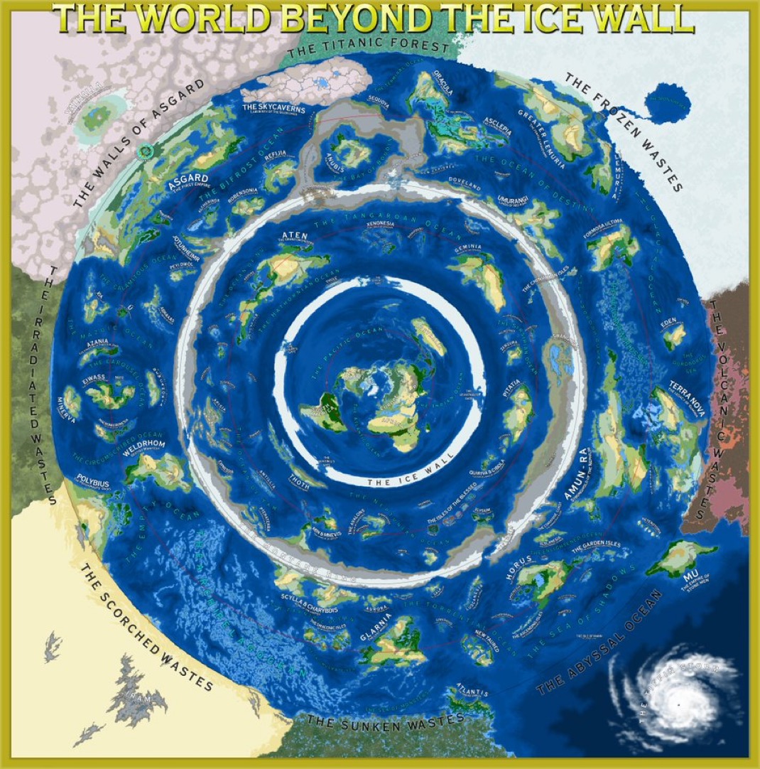
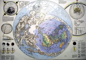
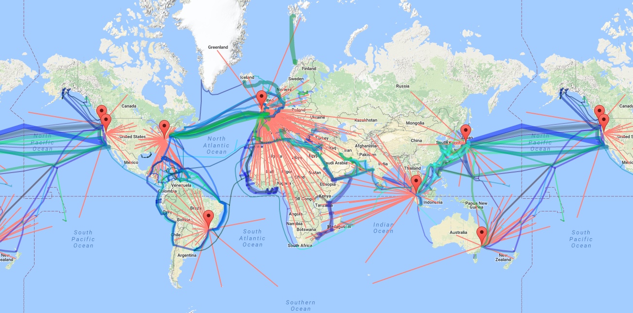
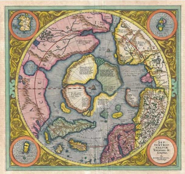
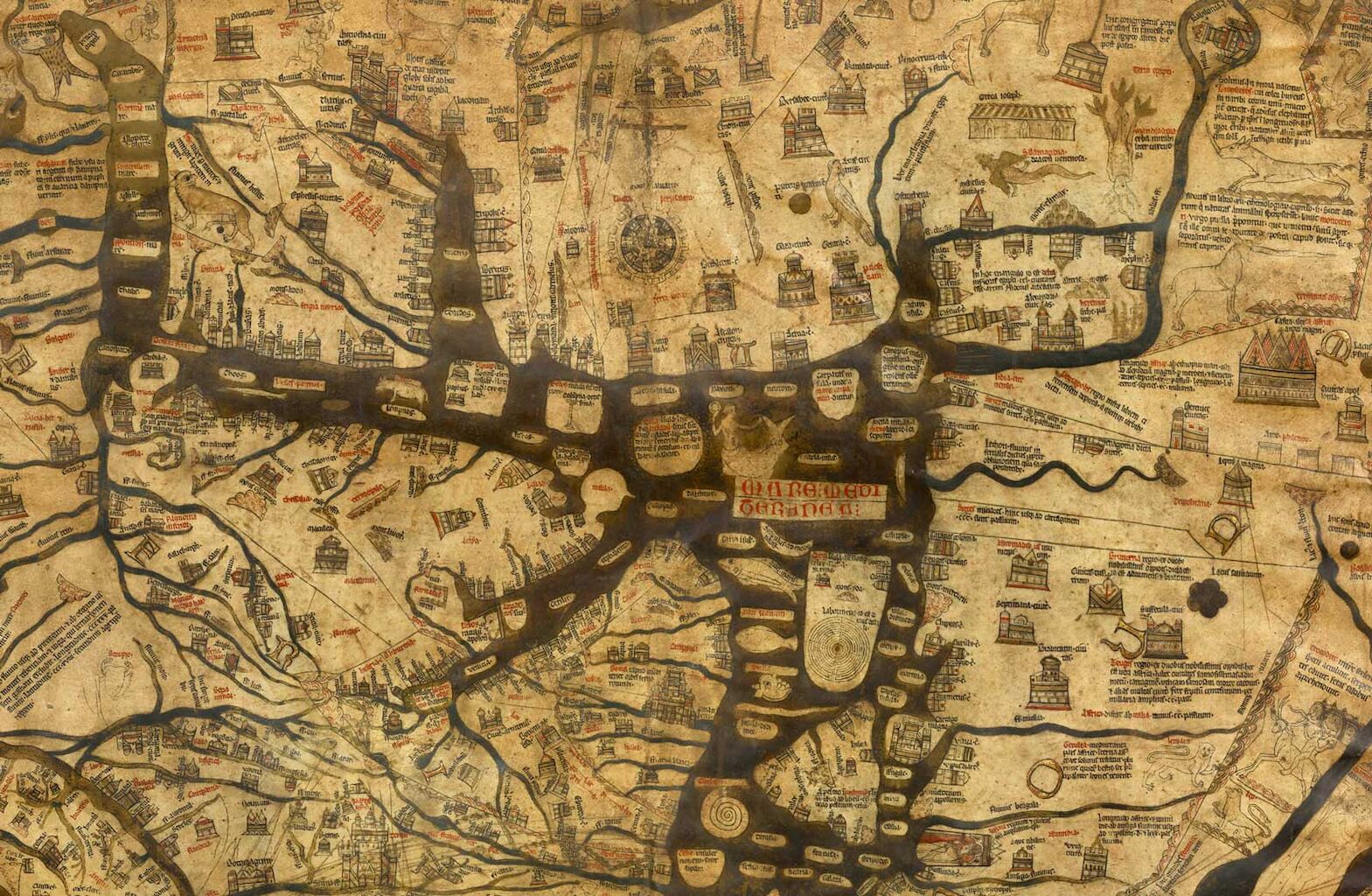
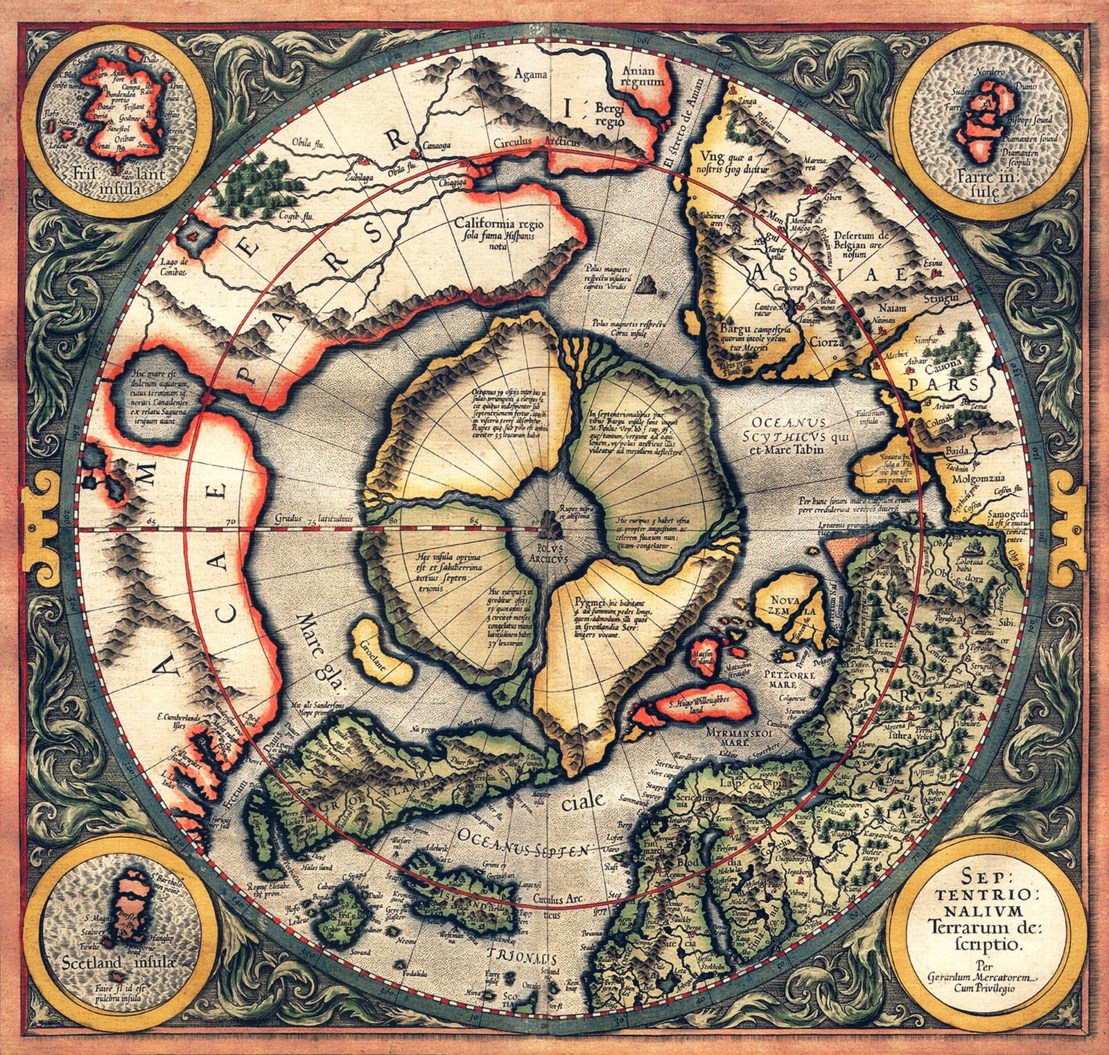
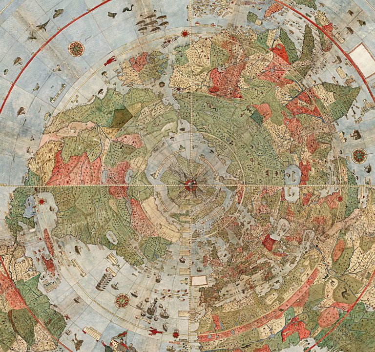
Here is another depiction of  the various Worlds beyond our Ice Wall.

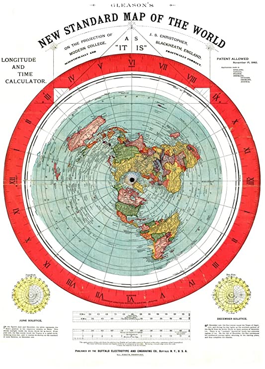
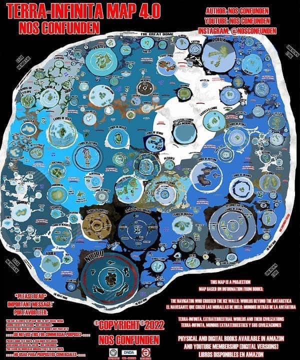
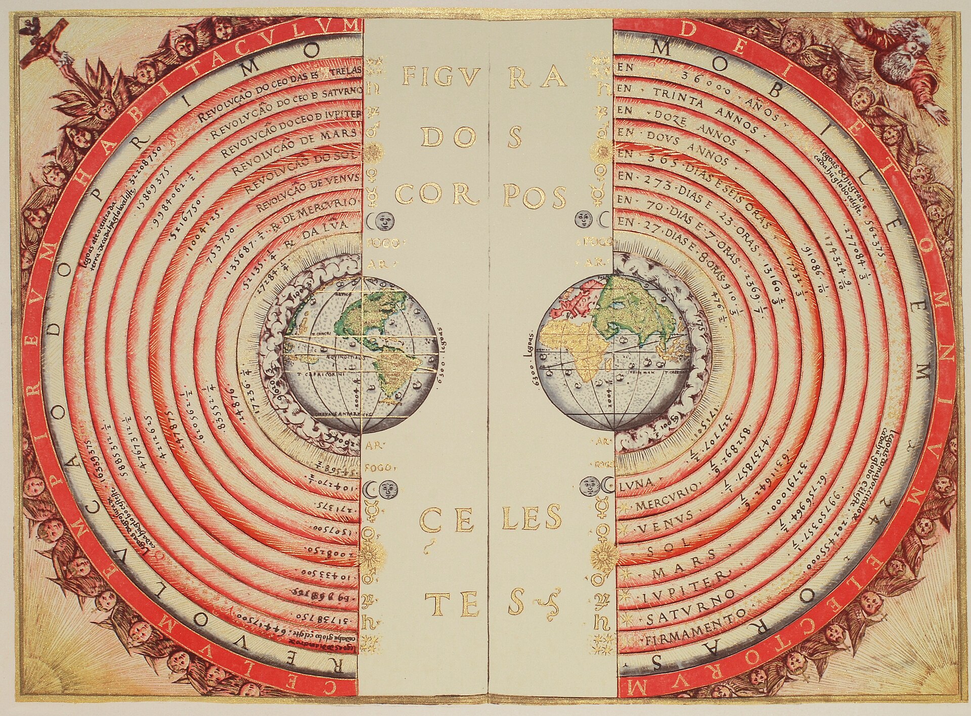
Here is an interesting find. I’m not sure how much of it is true or accurate, but it is definitely interesting.
Claudio Nocelli, the author of Terra-Infinita: Extraterrestial Worlds and Their Civilizations writes about Helen Morris and her father William Morris, who together with the help of a Giant, disclose information about all of the worlds beyond our Antarctic ice wall.
Our level Earth world, they say, is part of 178 worlds under a Great or Super Dome, each with its own domes or biospheres. Helen and William come from the Ancestral Lands, which are some 8000 kilometers south of our Antarctic ice wall. They have come here to try and educate and liberate our own humanity.

SCIENCE AND TECHNOLOGY

Evidence suggests that we live in an enclosed Plan-Et surrounded by a huge ice wall. There is a huge World beyond that wall but we are forbidden to go beyond the 60th Parallel to see it. No plane can fly over it.

SUBMARINE CABLE MAP: GLOBE EARTH

95% Of all communications in the World are carried by underwater cables.  So what do the satellites do?  And what would the map look like on the Gleason’s map? I bet the cables are a lot shorter.

SUBMARINE CABLE MAP: FLAT EARTH

I will be very interested to find a map that shows the cables on a Flat Earth Map.  Let’s see if the arrangement is more efficient.
Evidence suggests that we live in an enclosed Plan-Et surrounded by a huge ice wall. There is a huge World beyond that wall but we are forbidden to go beyond the 60th Parallel to see it. No plane can fly over it.

JET STREAM CURRENTS

The jet stream is a fast, narrow current of air flowing from west to east that encircles the globe (not to be confused with the Gulf Stream which is instead an ocean current of drifting seawater). It was first documented by Wasaburo Oishi, whose regular weather balloon launches from Japan in the 1920s invariably ended up flying out over the Pacific Ocean at a considerable rate (footnote #1).

SOURCE ARTICLE

JET STREAM CURRENTS ON FLAT EARTH

Jet streams make much more sense on Fishbowl Earth


Evidence suggests that we live in an enclosed Plan-Et surrounded by a huge ice wall. There is a huge World beyond that wall but we are forbidden to go beyond the 60th Parallel to see it. No plane can fly over it.

OCEAN CURRENTS ON WORLD MAP

What would these currents look like on the Gleason Map?

WHAT THE DOME IS MADE OF

SKYSTONE FOUND IN ANTARCTICA

Skystone is the material found by scientists in Antarctica that looks like ice but is able to grow and seal openings in the Ice. Skystone is believed to be the material that makes up the firmament; the fishbowl dome above the Earth.

THERE IS NO CURVE

Here are some of the thousand experiments that prove that water is flat; not curved around a sphere.
Experiement to test the curvature of the Earth.

Water Does Not Curve

Water does not curve.  It finds it’s own level.

Water Does Not Curve

Water does not curve.  It finds it’s own level.

Water Does Not Curve

Water does not curve.  It finds it’s own level.

Water Does Not Curve

Water does not curve.  It finds it’s own level.

Water Does Not Curve

Water does not curve.  It finds it’s own level.

Water Does Not Curve

Water does not curve.  It finds it’s own level.

Water Does Not Curve

Water does not curve.  It finds it’s own level.

Water Does Not Curve

Water does not curve.  It finds it’s own level.

FLAT EARTH CURVE CALC


This is the calculation Scientists agree is correct for calculating the horizon point. This is one way you can prove whether the Earth is sphere or flat. Many people have tested this calculation in the real world and proven the Earth is Flat. See the videos for yourself. Click on one of the images below to see it full size.
FULL CHART SHOWING CURATURE CALCULATIONS
CLOSEUP OF CHART TO SHOW CALCULATION
CLACULATION OF CURVATURE  MEASURES
FULL CHART TO CALCULATE CURVE.

AIR TRAVEL ROUTES

The Aeronotical Map is the Gleason’s Flat Earth Map.  Pilots use this map for flying all over the world. They don’t have to change the pitch of the Jet for a curved Earth and their gyroscopes are set to a flat Earth below.  Here are some examples of flights and Emergency landings that only make sense on a Gleason’s Flat Earth Map.

TRAVEL ROUTE: GLOBE VS GLEASONS MAP

It all starts to make sense when you look at it.

TRAVEL ROUTE: GLOBE VS GLEASONS MAP

It all starts to make sense when you look at it.

TRAVEL ROUTE: GLOBE VS GLEASONS MAP

It all starts to make sense when you look at it.

THESE FLIGHT ROUTES DON’T EXIST

The official reason for not letting planes fly over the Antarctic is becaus it might scare the penguins…really.

PILOT’S CHALLENGE TO FLAT EARTHERS

This pilot has some great content.  He thinks Flat Earthers are crazy but he would love to do a flight over the Ice Wall to settle the questions one and for all.  I hope it happens.
Pilot offers a challenge to Flat Earthers to fly from Argentina to Perth Australia to prove once and for all whether the Earth is Flat or not. 
Pilot offers a challenge to Flat Earthers to fly from Argentina to Perth Australia to prove once and for all whether the Earth is Flat or not.  AGAIN.

ANTARCTIC  CIRCLE: NOT A CONTINENT

WHAT  THE  ANTARCTIC  REALLY  IS


It’s called the “ANTARCTIC CIRC LE” for a reason.  It is not a continent  On the Gleason’s Map it shows as the white jagged border enclosing the Oceans of the World and surrounding the Continents.  We see the edge of this Arctic Circle as an Ice Wall and it is the highest Natural structure in the World; which it would have to be to hold in the Oceans.  It is 10,000 feet high around the perimeter.  We re banned from going beyond the 60th Parallel.  If a boat or plane tries, it is escorted back or the people are taken to prison.

MAP HISTORY

HISTORY  OR  WORLD  MAP  MAKING 

Here is the Chronological History of the Fishbowl Maps of the Known World.

LINKS:  History of Flat Earth Maps

325 BC


      PYTHEAS VOLYAGE TO THULE NORTH POLE

Pytheas of Massalia was a Greek geographer, explorer and astronomer from the Greek colony of Massalia. He made a voyage of exploration to Northern Europe in about 325 BC, but his account of it, known widely in antiquity, has not survived and is now known only through the writings of others. On this voyage, he circumnavigated and visited a considerable part of the British Isles. Wikipedia

ERIC DUBAY MADE A VIDEO TRACING THE EARLY VOYAGES TO THE NORTH POLE: 


100-1543 AD


GEOCENTRIC MODEL

The astronomical predictions of Ptolemy’s geocentric model, developed in the 2nd century of the Christian era, served as the basis for preparing astrological and astronomical charts for over 1,500 years. The geocentric model held sway into the early modern age, but from the late 16th century onward, it was gradually superseded by the heliocentric model of Copernicus, Galileo, and Kepler. There was much resistance to the transition between these two theories, since for a long time the geocentric postulate produced more accurate results. Additionally some felt that a new, unknown theory could not subvert an accepted consensus for geocentrism.

1300 AD     HEREFORD MAP

The Hereford Mappa Mundi is the largest medieval map still known to exist, depicting the known world. It is a religious rather than literal depiction, featuring heaven, hell and the path to salvation. Dating from c. 1300 AD, the map is drawn in a form deriving from the T and O pattern. It is displayed at Hereford Cathedral in Hereford, England. The map was created as an intricate work of art rather than as a navigational tool. Sources for the information presented on the map include the Alexander tradition, medieval bestiaries and legends of monstrous races, as well as the Bible. Wikipedia

REFERRED TO IN CRATER EARTH VIDEOS

1472 AD     T and O MEDIEVAL MAP

These were simple maps designed to show Jerusalem as the Center of the World.


1492   

ERDAPFEL GLOBE

Martin Behaim (6 October 1459 – 29 July 1507) is now best known for his Erdapfel, the world’s oldest known globe, which he produced for the Imperial City of Nuremberg in 1492.


This Globe shows up at the same time as the Reset? FALL OF GRANADA above

1543  May 24


COPERNICUS HELIOCENTRIC THEORY PUBLISHED

Copernicus first published his theory of a Heliocentric Universe was published shortly before his death.

THE COPERNICUS 🕍 REVOLUTION: BITCHUTE
Copernican heliocentrism is the astronomical model developed by Nicolaus Copernicus and published in 1543. This model positioned the Sun at the center of the Universe, motionless, with Earth and the other planets orbiting around it in circular paths, modified by epicycles, and at uniform speeds. The Copernican model displaced the geocentric model of Ptolemy that had prevailed for centuries, which had placed Earth at the center of the Universe. Wikipedia

1569


MERCATOR  DRAWS FIRST MAP  OF NORTH POLE

Gerard Mercator’s 16th-century attempt at mapping the Arctic includes such guesses as a giant whirlpool and polar pygmies.

This is the famous Cartographer responsible for the making of the modern map we see displayed all over the world today.  And this is how he showed the North Pole Region.  The same as civilizations across time have described it again and again.  Until very recently.

1587  URBANO MONTE  MAP

The cartographer, Urbano Monte created a map of the Flat Earth in 60 parts that was not put together in one piece until centuries later.

1892


Gleason was born on November 28, 1827 – March 13, 1909, so was aged 65 years when releasing the map in 1892.

A Deep Dive into the Famous Gleason’s Flat Earth Map of 1892

 
Born in the United States, Alexander “Alex” Gleason resided in Buffalo, New York. He is listed as an assigner to the Buffalo Electrotype and Engraving Company in patent applications.  Gleason’s 1892 map bears a key phrase on the back: “The demonstration has reference to either considerations: the earth a globe or a plane—take your choice.

The map lists the following locations on the outer Antarctic ring:
South Victoria Land, Adelie Land (French), Clarie Land, North Land, Sabrina Land, Budd Land, Knox Land, Termination Land, Kemp Land, Enderby Land, Elephant Island, King George Island, Graham Land, Alexander Land, Franklin Island

1893

In 1893, Orlando Ferguson, a real estate developer based in South Dakota, drew a map of the Earth that combined biblical and scientific knowledge in a unique way. The map accompanied a 92-page lecture that Ferguson — referring to himself as a “professor” — delivered in town after town, traveling far and wide to share his theory of geography, highlighted by his belief that the Earth was flat.
Ferguson’s map represents the Earth as a giant, rectangular slab with a dimpled upper surface. Don Homuth of Salem, Ore., just donated one of two intact copies of the map to the Library of Congress. [See the map]

1931  October


Voliva‘s Flat Earth map. Modern Mechanics and Invention, October, 1931

From 1914, Voliva gained nationwide notoriety by his vigorous advocacy of the flat Earth doctrine. He offered a widely publicized $5,000 challenge for anyone to disprove the flat Earth theory. 
Voliva believed the idea of a sun millions of miles in diameter and 91,000,000 miles [146,000,000 km] away is silly. The sun is only 32 miles [51 km] across and not more than 3,000 miles [4,800 km] from the earth.

Voliva made it illegal to have a Globe in the classroom and taught Flat Earth Geography only.

1946

This WWII-era map shows the world on a polar projection, well-suited to emphasize distances by air across the globe. This new method of travel made formerly remote places more readily accessible and required a novel way of conceiving space and geographic relationships. In addition to the primary air routes between Allied powers, naval bases are identified with small red dots. The underlying image shows an interesting mix of pre-war territorial borders, omitting Italy’s 1936 conquest of Ethiopia but reflecting Britain’s split of Burma the following year.


Hammond air age map of the world. A polar projection. Garden city Publishing Co., Garden City, N.Y. Copyright By C.S. Hammond & Co., N.Y. Printed in U.S.A. (insets) Western hemisphere. (with) Eastern hemisphere. (with) Australasia and the Far East. (with) Mediterranean Sea. (with) (Pictorial map of western hemisphere).

ZOOM INTO MAP DETAILS HERE

1943-1946

FLAT EARTH.WS  debunking Flat Earth Website


In an article from 1943,  the writer describes this Map as a Flat Earth Map.  

ZOOM INTO MAP DETAILS HERE


This map is made on the North Polar Azimuthal Equidistant Projection. This means that the world has been projected on ta plane tangent to the North Pole, with the parallels of latitude as concentric circles, equally spaced from the pole outward. The meridians of longitude ar straight lines radiating from the pole. Every point on the map has a true direction, or azimuth, from the pole and also a true distance from the pole.